
KY
The KY Kirkcaldy Postcode Area
Welcome to the KY postcode area, covering the town of Kirkcaldy and surrounding areas in Fife, Scotland. Kirkcaldy is a charming coastal town on the east coast of Scotland, with a population of approximately 50,000 people.
The KY postcode area includes several other towns and villages, including Glenrothes, Kinghorn, and Burntisland. Glenrothes is a new town built in the 1940s and 1950s, with a range of modern amenities and facilities. Kinghorn is a small coastal village with a beautiful beach and a historic castle. Burntisland is another coastal town known for its sandy beach and annual summer fair.
Kirkcaldy itself has a rich history, with many historic landmarks and buildings. The town is home to the beautiful Ravenscraig Castle, a ruined castle dating back to the 15th century. Other notable landmarks include the Adam Smith Theatre, named after the famous economist who was born in Kirkcaldy, and the Kirkcaldy Museum and Art Gallery.
The area is also home to a range of outdoor attractions, including the Lomond Hills Regional Park, which offers stunning views and a range of outdoor activities such as hiking, cycling, and fishing. The Firth of Forth, which runs along the coast of the KY postcode area, is a popular spot for boating, kayaking, and other water sports.
Transport links in the KY postcode area are good, with easy access to both the M90 and A92 roads. Kirkcaldy train station offers regular services to Edinburgh, Dundee, and Aberdeen.
Overall, the KY postcode area is a beautiful and welcoming part of Scotland, offering a mix of history, culture, and outdoor attractions. Whether you are interested in exploring historic landmarks, enjoying the outdoors, or simply relaxing on the beach, there is something for everyone in this charming part of Fife.
KY is a postcode area located in Mid Scotland and Fife.
Neighbouring postcode areas include FK, KY, PH and DD
The area borders the coastal region of Forth and Tay
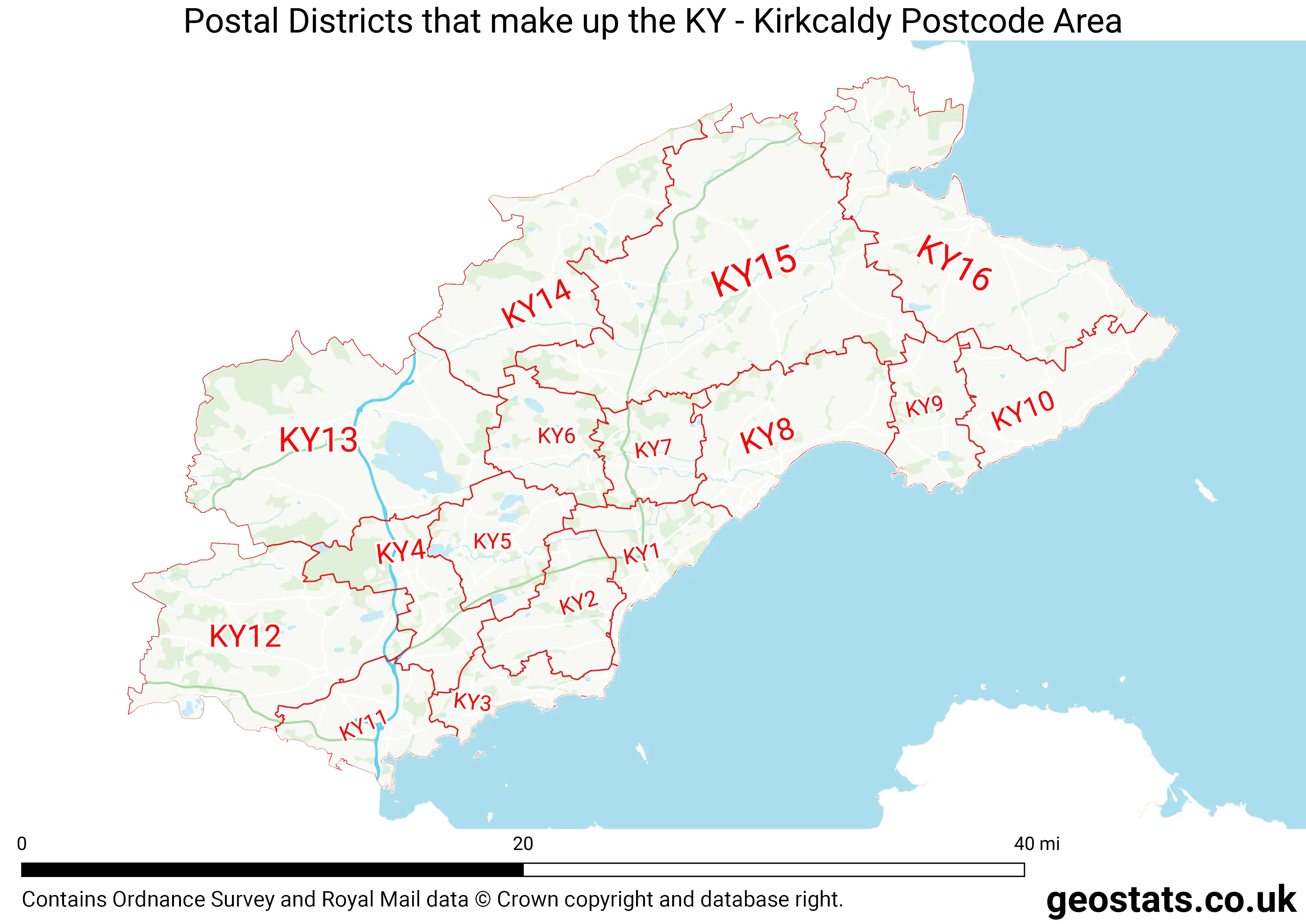
The KY Postcode Area consists of 17 postcode districts numbered from 1 to 99 and 69 postcode sectors.
This postcode area is named after the letters KY found in Kirkcaldy
There are around 257,192 properties in the KY Postcode Area
The are about 10,159 postcodes in the KY area.
KY has an area of 1,461,471,239 metres squared, which makes it 426 times bigger than the smallest postcode area (WC West Central London) and 11 times smaller than the largest postcode area (IV Inverness) . It has a perimeter of 381,248 metres.
Map of the KY Postcode
List of Towns in the KY Area
- Anstruther
- Auchtermuchty
- Buckhaven
- Burntisland
- Cowdenbeath
- Crail
- Cupar
- Dunfermline
- Falkland
- Glenrothes
- Inverkeithing
- Kinghorn
- Kinross
- Kirkcaldy
- Ladybank
- Leslie
- Leven
- Lochgelly
- Methil
- Newburgh
- Pittenweem
- St Andrews
List of Post Towns for the KY Sector
- ANSTRUTHER Fife
- BURNTISLAND Fife
- COWDENBEATH Fife
- CUPAR Fife
- DUNFERMLINE Fife
- GLENROTHES Fife
- INVERKEITHING Fife
- KELTY Fife
- KINROSS Kinross-Shire
- KIRKCALDY Fife
- LEVEN Fife
- LOCHGELLY Fife
- ST. ANDREWS Fife