
L
The L Liverpool Postcode Area
Welcome to the L postcode area, covering the city of Liverpool and surrounding areas in Merseyside, England. Liverpool is a vibrant and exciting city, known for its rich cultural heritage, famous music scene, and thriving nightlife.
The L postcode area includes several smaller towns and villages, including Bootle, Crosby, and Huyton. Bootle is a bustling town with a range of shops, cafes, and restaurants. Crosby is known for its beautiful beach and the famous art installation of Antony Gormley's "Another Place" sculptures. Huyton is a small town with a rich history and several historic landmarks, including Knowsley Hall and Estate.
Liverpool itself is a dynamic and exciting city, with a range of cultural attractions, shopping destinations, and dining options. The city is known for its maritime history, with the famous Albert Dock being a popular spot for visitors to explore. Other notable landmarks include the Liver Building, the Tate Liverpool, and the Beatles' childhood homes.
The city is also home to two major football clubs, Liverpool and Everton, who both play at the famous Anfield and Goodison Park stadiums respectively. Football is a major part of the culture and identity of the city, with match days being an exciting and vibrant experience.
Transport links in the L postcode area are excellent, with easy access to both the M62 and M53 motorways. Liverpool John Lennon Airport offers flights to destinations across Europe, while Liverpool Lime Street train station provides regular services to cities across the UK.
Overall, the L postcode area is a diverse and exciting part of England, offering a mix of cultural attractions, history, and modern amenities. Whether you are interested in exploring the city's rich cultural heritage, enjoying its nightlife, or simply taking in the stunning coastal scenery, there is something for everyone in this vibrant and welcoming part of Merseyside.
L is a postcode area located in England's North West Region.The Postcode Area covers the landscape areas of Lancashire and Amounderness Plain, Lancashire Coal Measures, Mersey Valley, Merseyside Conurbation and Sefton Coast
Neighbouring postcode areas include PR, L, WA and WN
The area borders the coastal regions of Blackpool Coastal Waters and Ribble Estuary and Dee and Mersey Estuaries and Coastal Waters
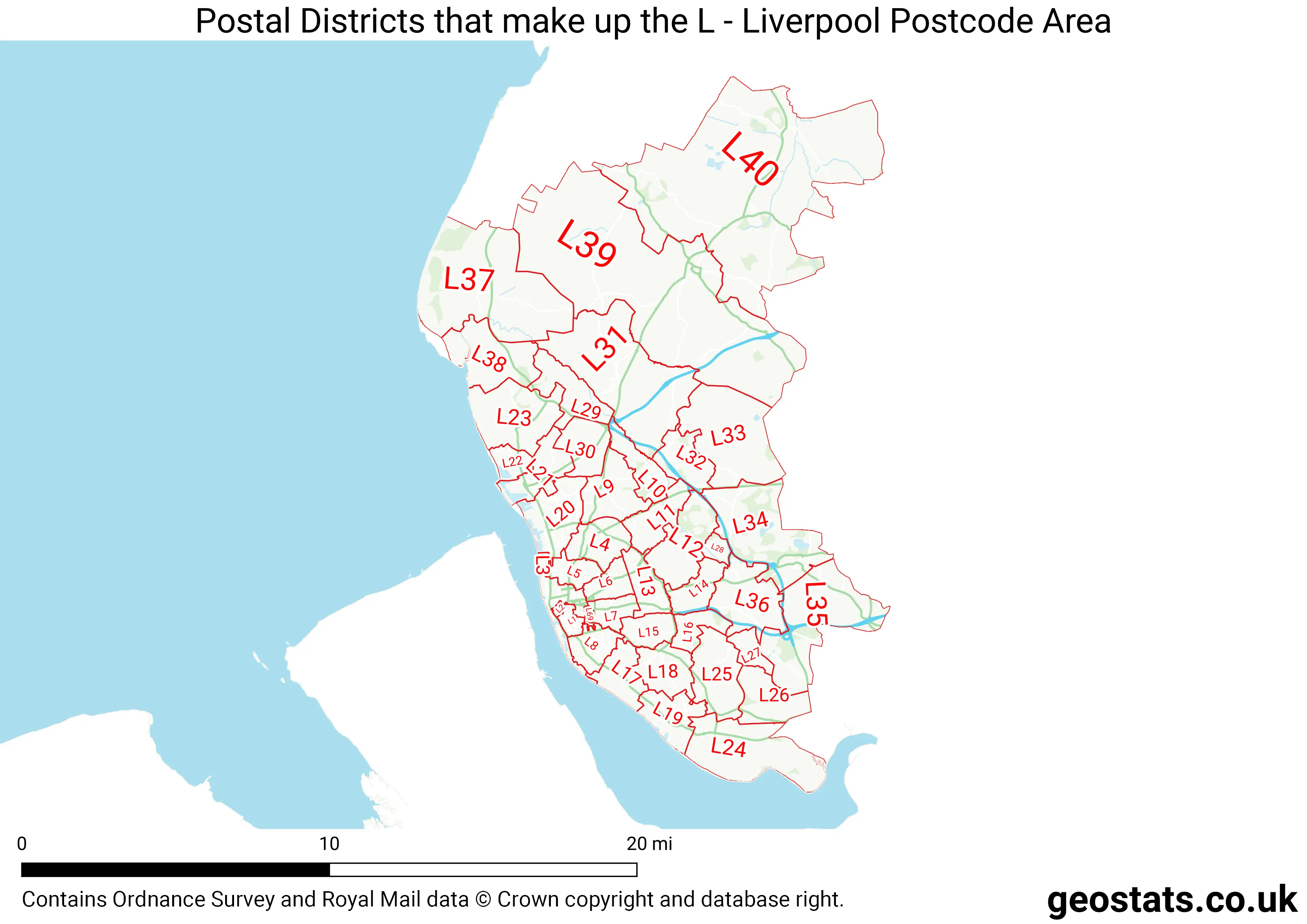
The L Postcode Area consists of 49 postcode districts numbered from 1 to 80 and 415 postcode sectors.
This postcode area is named after the letters L found in Liverpool
There are around 573,549 properties in the L Postcode Area
The are about 20,504 postcodes in the L area.
L has an area of 513,621,907 metres squared, which makes it 150 times bigger than the smallest postcode area (WC West Central London) and 31 times smaller than the largest postcode area (IV Inverness) . It has a perimeter of 187,309 metres.