
ST
The ST Stoke-on-Trent Postcode Area
If you're looking for a great place to live in the UK, Stoke-on-Trent is definitely worth considering. The ST postcode area covers the city and surrounding areas, offering a mix of urban and rural living with excellent transport links. Stoke-on-Trent is a vibrant city known for its rich industrial heritage and world-renowned pottery industry. The city is home to several museums and galleries, including the Potteries Museum & Art Gallery and the Gladstone Pottery Museum. The area is also home to several stunning parks and countryside areas, including the Staffordshire Moorlands and the Peak District National Park. The ST postcode area is made up of several districts, including Burslem, Tunstall, Stoke-upon-Trent, Hanley, Longton, and Fenton. Each district has its own unique charm and character, with a range of housing options, shops, and local amenities. One of the perks of living in the ST postcode area is the excellent transport links. Stoke-on-Trent is conveniently located in the heart of the UK, with easy access to major motorways and rail links. The city's main train station provides frequent services to London (under two hours), Manchester, Birmingham, and other major UK cities. For families, the ST postcode area offers a range of excellent schools and colleges, as well as a variety of leisure and entertainment options. The city centre has a range of shops, restaurants, and cafes, while the outlying districts offer a quieter, more peaceful way of life. Overall, the ST Stoke-on-Trent postcode area is a great place to live, work, and raise a family. With its rich history, stunning countryside, and convenient transport links, this area of the UK is definitely worth considering when looking for your next home.The majority of ST is located in England's West Midlands Region.The Postcode Area covers the landscape areas of Cannock Chase and Cank Wood, Needwood and South Derbyshire Claylands, Potteries and Churnet Valley, Shropshire, Cheshire and Staffordshire Plain, South West Peak and White Peak
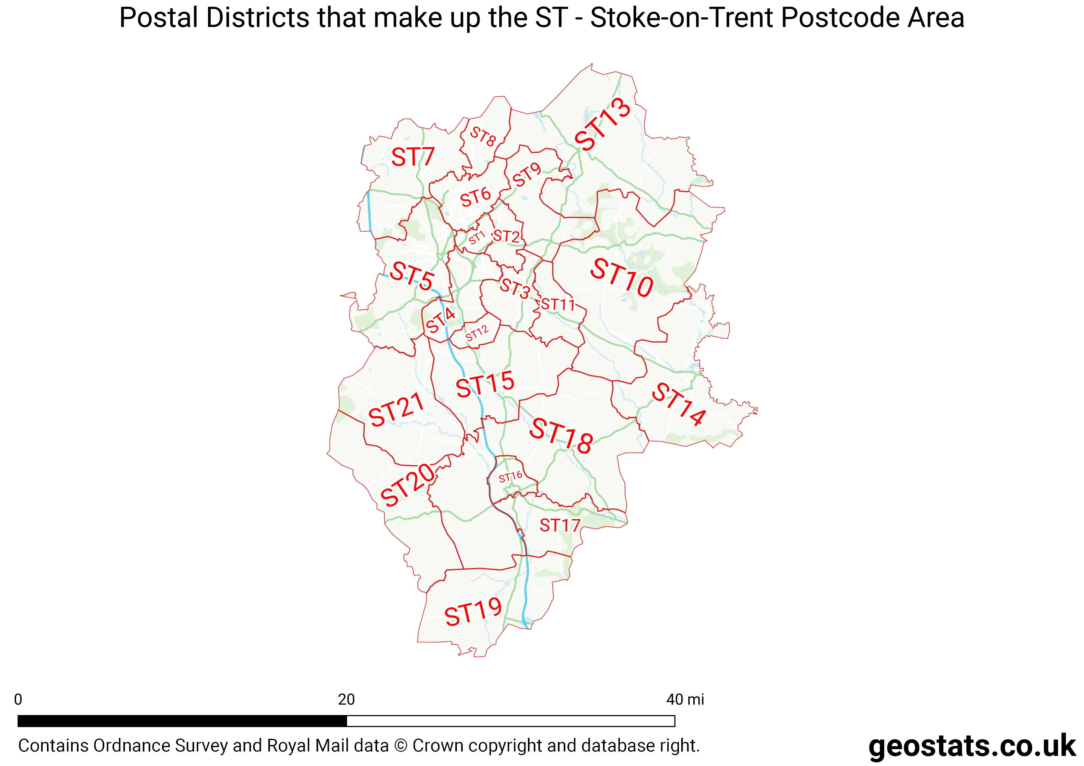
Neighbouring postcode areas include ST, DE, CW, WV, WS, SK and TF
The ST Postcode Area consists of 22 postcode districts numbered from 1 to 55 and 90 postcode sectors.
This postcode area is named after the letters ST found in Stoke-on-Trent
There are around 404,776 properties in the ST Postcode Area
The are about 17,683 postcodes in the ST area.
ST has an area of 1,485,757,168 metres squared, which makes it 433 times bigger than the smallest postcode area (WC West Central London) and 11 times smaller than the largest postcode area (IV Inverness) . It has a perimeter of 304,990 metres.
Map of the ST Postcode
List of Cities in the ST Area
- Stoke-on-Trent
List of Towns in the ST Area
- Alsager
- Biddulph
- Cheadle
- Eccleshall
- Leek
- Newcastle-under-Lyme
- Penkridge
- Stafford
- Stone
- Uttoxeter
List of Post Towns for the ST Sector
- LEEK Staffordshire
- NEWCASTLE Staffordshire
- STAFFORD Staffordshire
- STOKE-ON-TRENT Staffordshire
- STONE Staffordshire
- UTTOXETER Staffordshire