
HP
The HP Hemel Hempstead Postcode Area
Welcome to the HP postcode area, home to the charming town of Hemel Hempstead and its surrounding areas. Located in Hertfordshire, just a short train ride from London, this area is a popular destination for visitors and a great place to call home.
Hemel Hempstead is a vibrant and bustling town that offers a range of amenities and attractions. The town centre is home to a variety of shops, cafes, and restaurants, as well as the popular Marlowes Shopping Centre. The nearby Old Town, with its quaint cobbled streets and historic buildings, is a must-visit for anyone in the area.
For those who enjoy the great outdoors, the HP postcode area has plenty to offer. The town is surrounded by beautiful countryside, including the Chiltern Hills, an Area of Outstanding Natural Beauty. The Grand Union Canal runs through Hemel Hempstead, providing a picturesque backdrop for walks and bike rides.
Hemel Hempstead is also home to several cultural attractions. The Old Town Hall is a beautiful Victorian building that has been converted into a theatre and arts centre. The town also has several museums, including the Dacorum Heritage Trust Museum, which showcases the area's rich history.
The surrounding areas of the HP postcode area offer a mix of rural and village life. The charming villages of Kings Langley and Chipperfield are just a short drive away and are home to several historic buildings and local pubs.
Transport links in the HP postcode area are excellent, with easy access to the M1 motorway and regular train services to London and the rest of the country. The nearby Luton Airport provides further connections to destinations both in the UK and abroad.
Overall, the HP postcode area offers a unique blend of natural beauty, cultural attractions, and urban amenities. It's no wonder that Hemel Hempstead and its surrounding areas are consistently ranked among the best places to live in the UK.
The majority of HP is located in England's South East Region.The Postcode Area covers the landscape areas of Bedfordshire and Cambridgeshire Claylands, Chilterns, Midvale Ridge, Thames Valley and Upper Thames Clay Vales
Neighbouring postcode areas include OX, RG, LU, MK, HP, AL, WD and SL
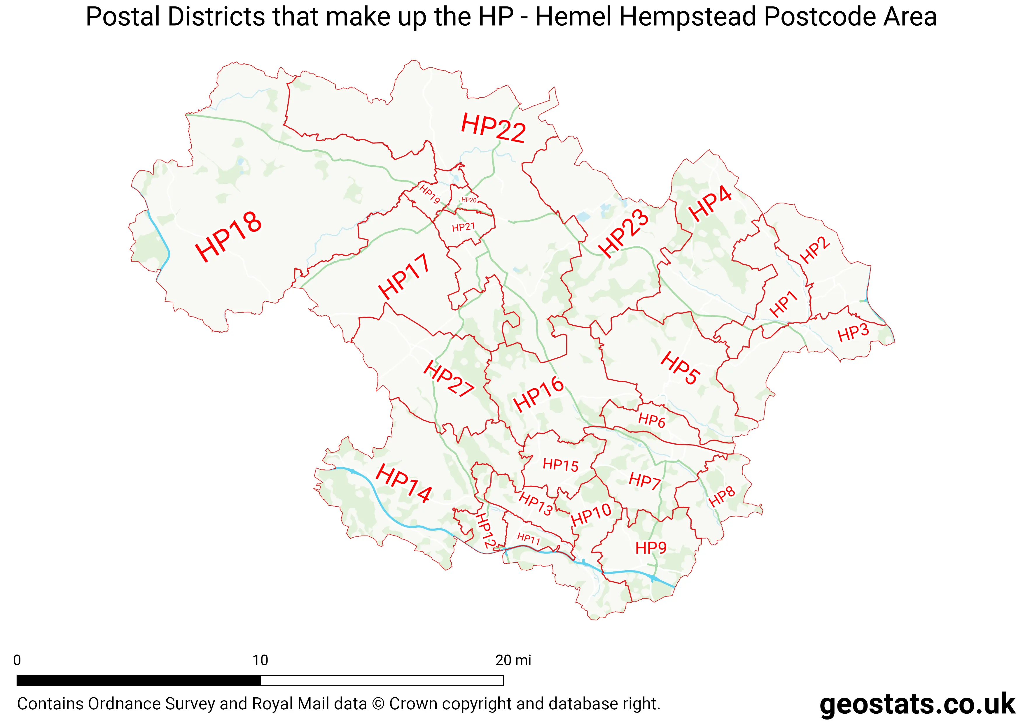
The HP Postcode Area consists of 24 postcode districts numbered from 1 to 27 and 78 postcode sectors.
This postcode area is named after the letters HP found in Hemel Hempstead
There are around 302,149 properties in the HP Postcode Area
The are about 14,017 postcodes in the HP area.
HP has an area of 1,025,834,011 metres squared, which makes it 299 times bigger than the smallest postcode area (WC West Central London) and 16 times smaller than the largest postcode area (IV Inverness) . It has a perimeter of 289,003 metres.
Map of the HP Postcode
List of Towns in the HP Area
- Amersham
- Aylesbury
- Beaconsfield
- Berkhamsted
- Chesham
- Hemel Hempstead
- High Wycombe
- Princes Risborough
- Tring
- Wendover
List of Post Towns for the HP Sector
- AMERSHAM Buckinghamshire
- AYLESBURY Buckinghamshire
- BEACONSFIELD Buckinghamshire
- BERKHAMSTED Hertfordshire
- CHALFONT ST. GILES Buckinghamshire
- CHESHAM Buckinghamshire
- GREAT MISSENDEN Buckinghamshire
- HEMEL HEMPSTEAD Hertfordshire
- HIGH WYCOMBE Buckinghamshire
- PRINCES RISBOROUGH Buckinghamshire
- TRING Hertfordshire