
SR
The SR Sunderland Postcode Area
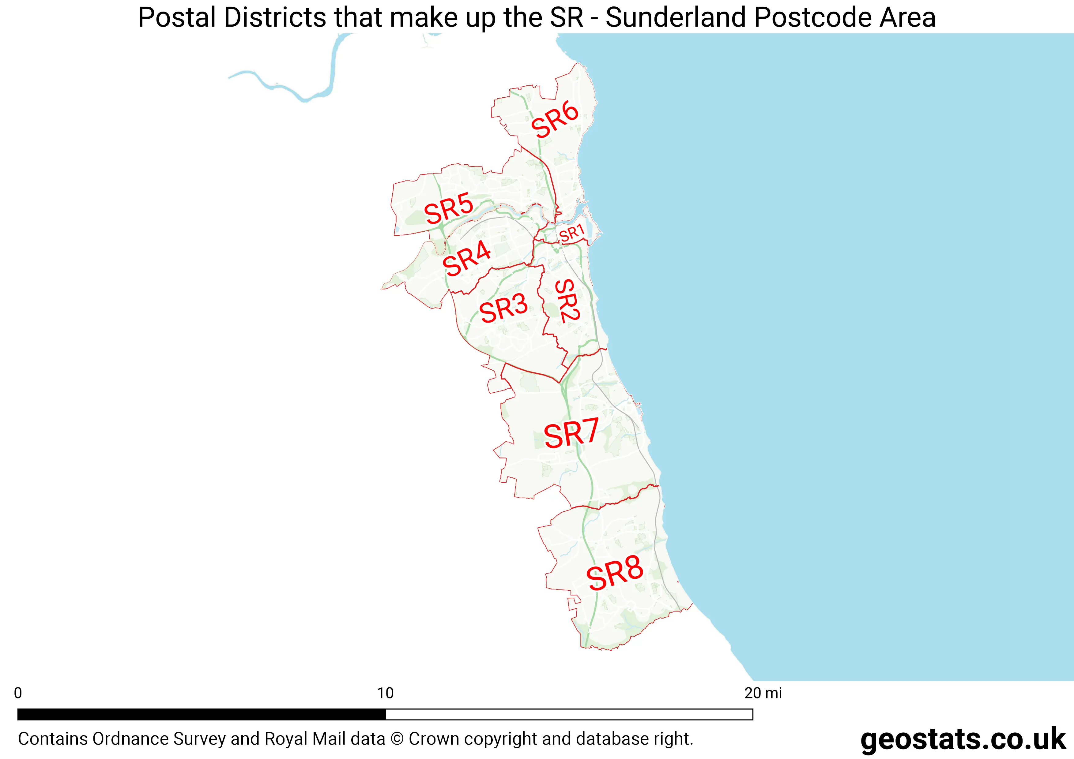
Are you looking for a place to call home in Sunderland? Have you considered the SR postcode area? This vibrant and diverse area is home to a wide range of communities and offers something for everyone. Here's everything you need to know about the SR Sunderland postcode area. The SR area covers a large part of Sunderland and includes the following areas: East Boldon, Cleadon, Whitburn, Seaburn, Fulwell, Ryhope, Silksworth, Tunstall, Doxford Park, and Houghton-le-Spring. Each of these areas has its own unique character and charm, making the SR postcode area a varied and exciting place to live. One of the biggest advantages of living in the SR area is its proximity to the coast. Seaburn and Whitburn are both coastal towns that offer stunning views and plenty of outdoor activities, including walking, cycling, and water sports. The area is also well-connected to the rest of Sunderland and the North East of England, with easy access to major road networks and public transportation. In terms of amenities, the SR postcode area has everything you need. There are plenty of shops, restaurants, and pubs in the area, as well as a range of cultural and entertainment venues. The Sunderland Empire Theatre and the Stadium of Light, home of Sunderland Football Club, are both located in the SR area and provide plenty of opportunities for entertainment and sport. If you have children, you'll be pleased to know that the SR area has a range of excellent schools, both primary and secondary. There are also plenty of parks and green spaces in the area, making it a great place for families to enjoy outdoor activities. Overall, the SR Sunderland postcode area is a fantastic place to live. With its diverse communities, stunning coastal views, convenient location, and excellent amenities, it's no wonder that so many people choose to call this area home. Whether you're a young professional, a family with children, or a retiree, the SR postcode area has something to offer everyone.SR is a postcode area located in England's North East Region.The Postcode Area covers the landscape areas of Durham Magnesian Limestone Plateau and Tyne and Wear Lowlands
Neighbouring postcode areas include TS, NE, DH and SR
The area borders the coastal regions of Tyne and Tees and Wear Estuaries and Coastal Waters
The SR Postcode Area consists of 8 postcode districts numbered from 1 to 8 and 37 postcode sectors.
This postcode area is named after the letters SR found in Sunderland
There are around 150,973 properties in the SR Postcode Area
The are about 6,539 postcodes in the SR area.
SR has an area of 143,391,514 metres squared, which makes it 42 times bigger than the smallest postcode area (WC West Central London) and 112 times smaller than the largest postcode area (IV Inverness) . It has a perimeter of 127,027 metres.